St. Croix River (Riverside Landing to Thayer Landing), Burnett/Pine County (13 mi)

It was too nice a weekend to not paddle.  And as I learned this winter, there isn’t always what you need to do the sport that you want to do.  With skiing, that’s snow.  With paddling, that’s water.  And water only gets lower as spring moves to other seasons.  And when there’s not much snow, and no snowpack, there aren’t spring water levels.  The St. Croix has good data for water levels, but it looked ‘average’ – and I don’t mean average for spring, but average, not high.  I didn’t want to paddle much for rapids since I was going alone, and didn’t want to get stuck either with ‘average’ water levels.  Based on that, and where Ryan was coming from (to shuttle me and bike on his own) I chose to paddle Riverside to Thayer.  

I’ve been to Riverside a few times, a takout point for the Namekagon and Totogatic (as there is nothing after the confluence of either of those rivers).  I recognized the landing right away, and got my kayak ready for the water.  As I neared the water, dragging my boat close, I saw the poison ivy berries haunting me along the edge.  It’s really the only reason  notice the plant in the winter, a warning to keep my distance!

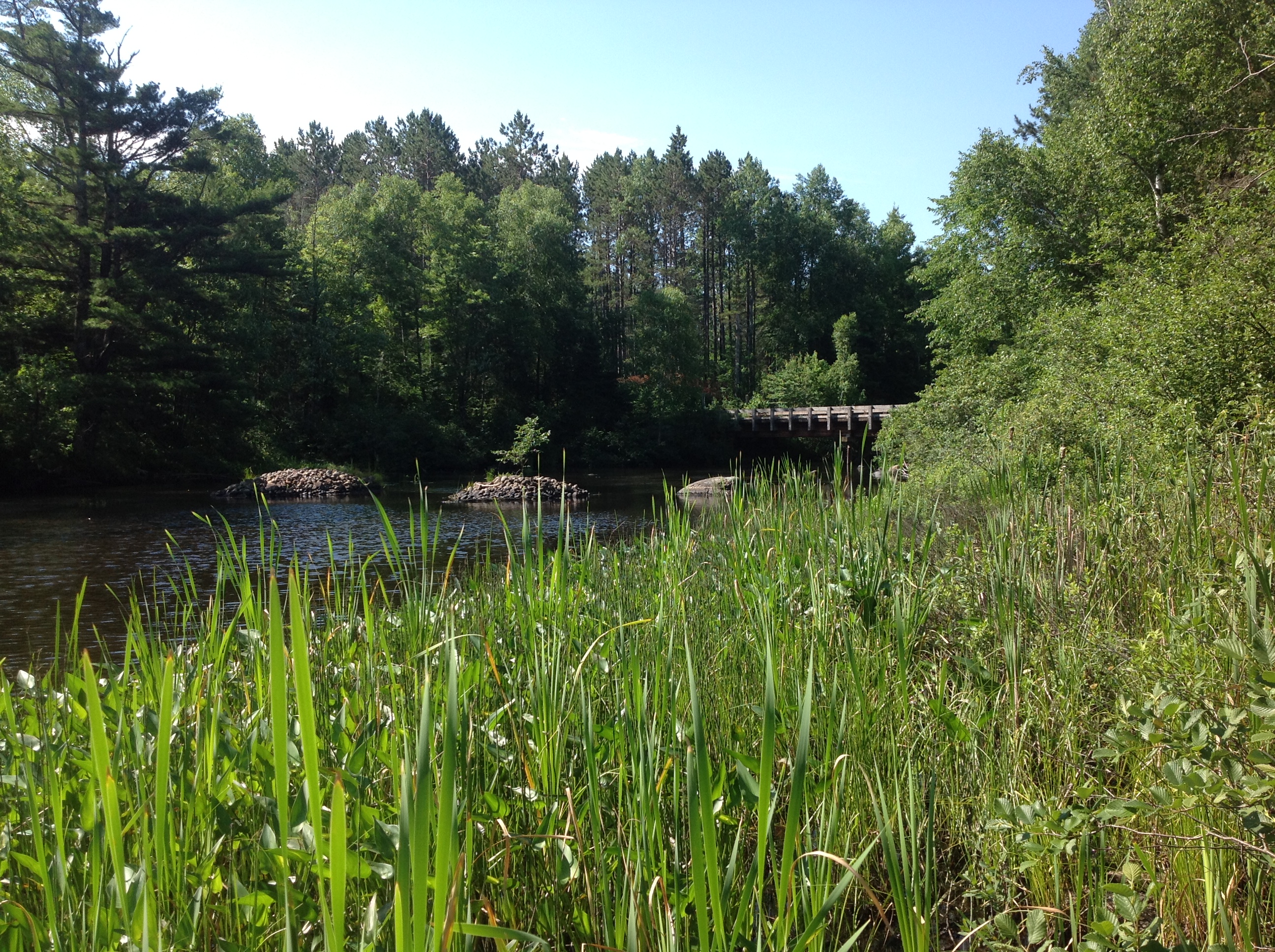
Once on the river, I took in the fresh air and sunshine.  I was soon under the bridge, and as I do, I started naming the plants.  There wasn’t much for animals.  I came alongside the western bank, talking to my phone (or myself?) to record the plants I was seeing.  There was a pretty flower of a shrub (not showy, but showy for a wind-pollinated early spring flower – Myrica I believe).  “Who are you” I asked it and…. an animal upstream popped out.  What was a porcupine going to do?! It looked at me, wondering who was.  And then my brain came on board, as it slipped into the water, not twenty feet from where I was (though I was floating downstream quickly) – it was a beaver!  It slid into the water and swam upstream on the surface, not too bothered by me.  So the highlight of the day may have been in the first ten minutes.  The third beaver I’ve seen this year.  I think I’ve seen three other beavers in my whole life.  Interesting, amik is telling me something?

I sat there dazed, surprised that a beaver just came off the shore, looked at me for a few long seconds sizing me up, and swam away.  The kayak kept floating downstream.  I figured I should get straight with the river, and turned to watch the banks go by.  Most of this section had a wide open floodplain, with some higher hills on the east.  There are some rapids shown about 2 miles in, and I wondered if they would be rapids, as sometimes they overemphasize rapids on the maps to keep people safe.  I could eventually see them ahead, they made noise, and I was a bit nevous.  In the end, they were not much.  Riffles to class 1.  

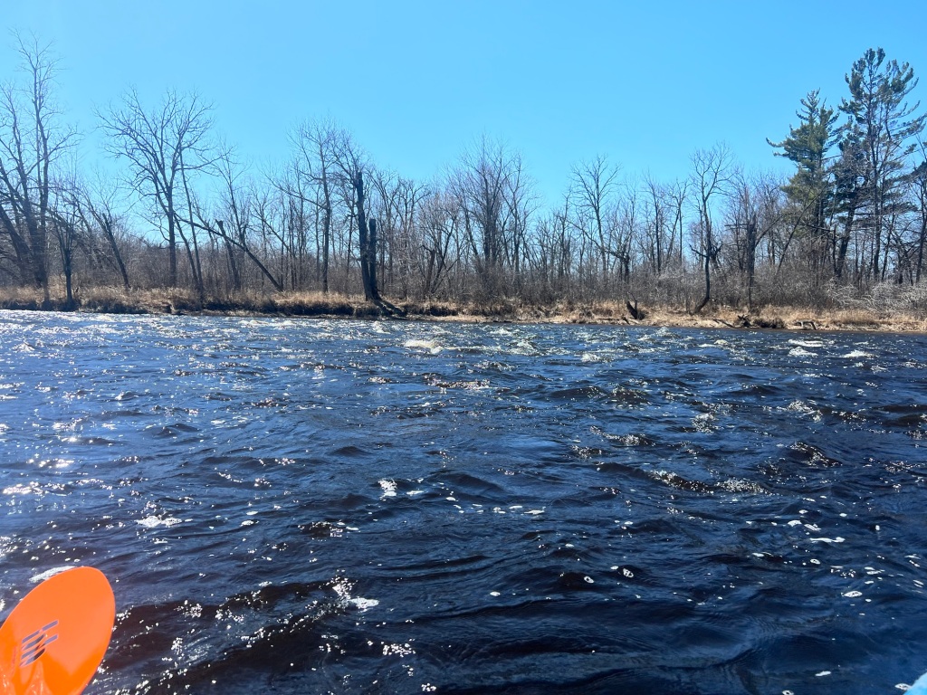
Overall, this section is slow and wide.  There isn’t a lot of note along the way.  There are some islands that you go by in some parts. (I hadn’t checked all my books prior to the paddle, Pansy Landing is noted in my books, about 4 miles in, but is not mentioned in the NPS maps. I was not looking for it and didn’t see it.)  There are a few campsites (I stopped at the one by Crystal Creek (125.5) and it seemed like a quaint site right by the creek).  As the river nears Danbury, you can see the town. You can hear some cars too, but it’s not a super busy highway.  Interestingly, I noticed the birdsong picked up as I turned the corner and could see Danbury.  Having paddled the Yellow River, I believe that there is a landing right at the confluence that isn’t on the map.  (Checking my ‘Paddling Northern WI’ book, it does show a landing there. An older NPS map shows that it’s a landing that has a few and I noted that it’s a tribally owned landing). There were some people fishing below the bridge over the Yellow.  It didn’t look like a river that could be paddled from where I was at, but I do know that I came out there!

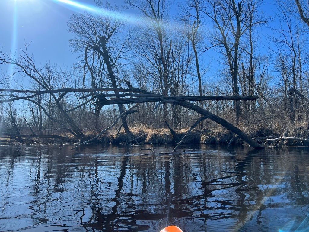
The river goes under the Gandy Dancer Trail (an old railroad bridge) and heads away from town, wide and slow still.  It got windy on this part, but I kept my pace and the wind wanted me go go upstream.  It did let up, and I could finally check the map.  I passed a campsite with a torn up sign at it.  I thought I was further than I was. The site was probably right near the Lower Tamarack River.  I soon passed Lower Tamarack Landing, first a dead end with an eroded riverbank, and then the actual landing with a sign, and realized that the campsite was likely one destroyed by the flooding a few years ago.  The campsite on the map is after the landing.  

I knew I was getting close now, and Ryan said to let him know when I could see the Highway 77 bridge.  Of course, with a mile left, my cell servi ce disappeared (which maybe I remember from these parts on other trips).  I saw the bridge ahead and knew that there was a rapid/ledge right before the bridge and to stay on the Wisconsin side of the river (the NPS map had that written on it).  I did finally get a text through, stayed left, and saw Ryan come under the bridge to get my picture as I finished.  I knew this landing too, I had waited here for Ryan to shuttle for another recent trip.  It was a beautiful day to get out on the river, in a spring that won’t yield a lot of snowmelt.  It’s a good paddle for lower water levels!

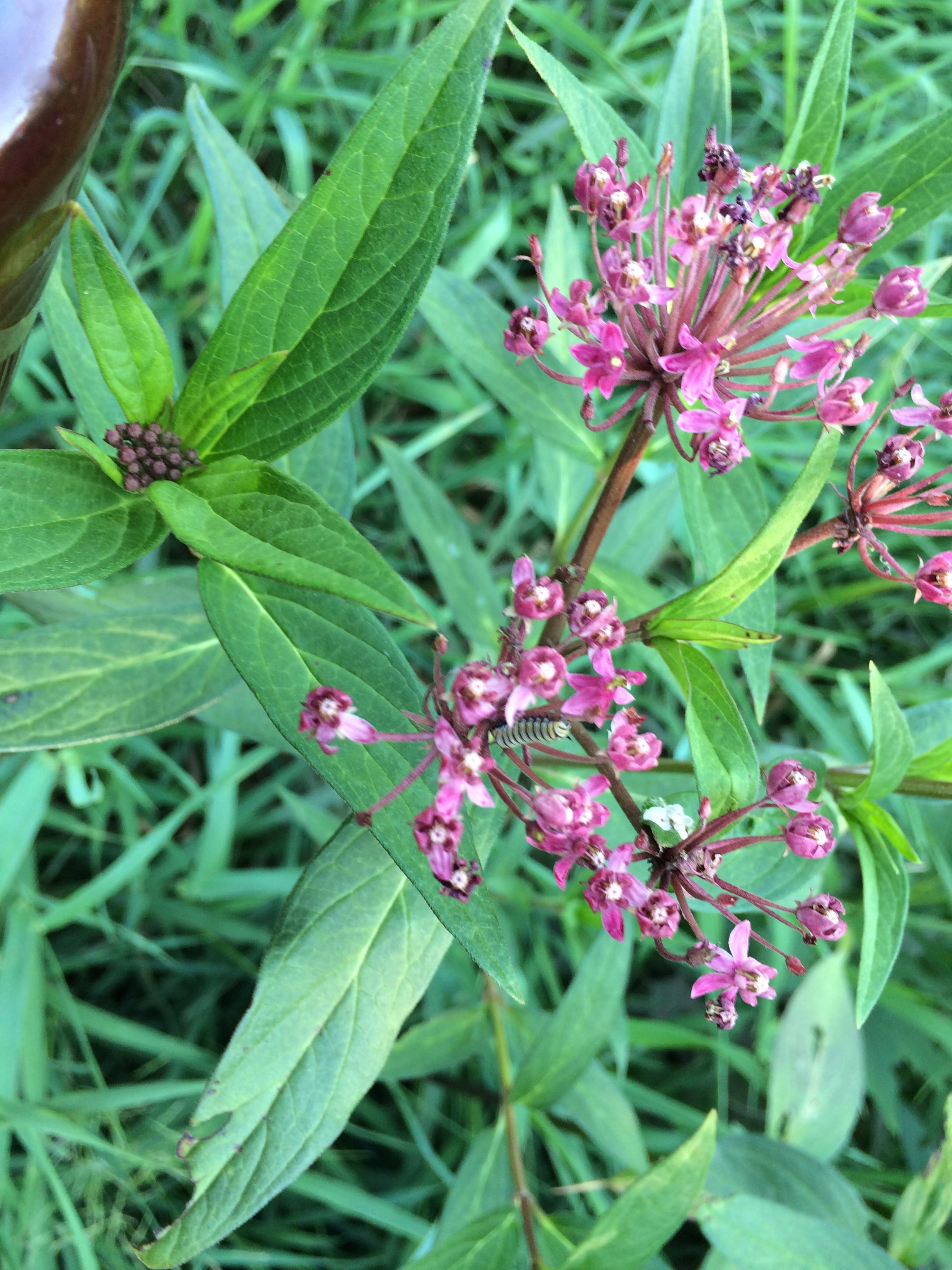
Other beings seen include: Reed canary grass, aspen, red oak, burr oak, sand barrens, red-osier dogwood, poison ivy, ash, hazelnut, white pine, blue dragonfly, silver maple, turkey vultures, wood duck, red maple eagle, merganser, mallard, frogs croaking, juvenile eagle, redwing blackbird, dead elm, swamp milkweed, baby nettles, raven, painted and soft shell turtles, smartweed, tamarack, white birch

Paddled April 14, 2024

I used NPS maps for this section.  I also have a few others for reference but didn’t read up prior to the paddle.  

Weather: sunny, 60s, windy

Time paddling: 3.75 hours

Water level: 1860 cfs near Danbury

Namekagon River, Big Bend Landing to Trego Revamped (7.7 miles)

This is such a popular paddle, and I do it feel like I did it justice on it’s first post in 2016. For one, I have pictures now!

I recently did this paddle with a group of middle and high schoolers and it was a very pleasant day. As noted before, you want to avoid summer weekends, so that you do not have lots of other people around you o the river, drinking. I have heard from rangers that it is getting worse. The Apple River has cracked down on their party status, and now people are coming up here more to do just that. There may be some intervention on this in the future, but for now, you can just choose to avoid the area on the best summer weekend days.

There are a few campsites along this stretch of river, most in the first half of the trip. There was a couple camping at one of the sites as we paddled by, and another group taking a break at another one.

This section of river meanders through forest and marsh, creating some islands in the lowlands. We put in at Big Bend Landing, where the river actually is going around a horsehoe turn for the first half of the trip. The river is wide and calm on the turn, and is very beautiful in the fall. We lunched at the Earl Landing, which has camping, water and pit toilets. This is where many of the outfitters put in and there is a nice new boat ramp to drop off canoes and tubes. If you take out here for a rest, remember to be courteous so that if others come to drop boats off, your belongings are not in their way. After the Earl Landing, the river continues to meander through forest and high banks, and there are some riffles (some may consider them Class I rapids). There are also strainers along the side of the river. We did have a canoe tip because of a strainer – they all leaned away from it… and the boat tipped. Know how to avoid the strainers and boulders in the river, and how to react if you do end up close to them.

After the first Highway 63 bridge, the river weaves through low wetlands creating sandbars and islands. The river can be very shallow, but it isn’t too hard to find the main channel and continue downstream. The river goes under Highway 63 again and is wider, with higher riverbanks.

The river has many plant species along it, including pine, oak, white birch, tag alder, maple, wild rose, sedges and cattail. A plant that has been prolific statewide in 2018 is the wild cucumber. It is a vine that can cover the top of trees and kind of looks like a blanket over them. We explored some ripe cucumbers. It appears that the end of the ‘cucumber’ falls off, and the seeds, when ripe, fall out. There are a few chambers of seeds, and two seeds in each chamber. Nothing would probably eat it, it is quite bitter, slimy – and in the winter you can see their skeletons handing from the vine still. The Trego Nature Trail goes along the north side of the river for most of the stretch south of Highway 63. We did see eagles on this section of river.

The take-outs are obvious – Lakeside Road Landing (river right) and one right across from it near the Namekagon River Visitor Center (river left). If you continue, there is a take-out at Trego Town Park (river right) or you can go under a very low red walking bridge. This quickly takes you under US Highway 53 onto Trego Lake.

image

There is a great deal of information on this section of the river – Paddling Northern Wisconsin by Mike Svob, Canoeing the Wild Rivers of Northwest Wisconsin and https://www.nps.gov/sacn/planyourvisit/upload/2014-Namekagon-Map2BW.pdf from the National Park Service are great resources.


Most recently paddled Sept 11, 2018

Yellow River – Green Valley Road landing (Tozer Lake Bridge) to Swan Bridge Road (~7 miles?)

I have done this section of river a few times before. I decided again to lead two Wisconsin Natural Resources Foundation (NRF) trips (http://www.wisconservation.org/field-trips/) on the river this year, with Joan Jacobowski, who works with the National Park Service when she isn’t foraging or volunteering. As I prepped for the first trip, I was surprised that I hadn’t written about it yet. I guess a few rivers slip through, and even now, I write months after I write about this river (I did take notes both times I was out this summer!)

This river is a bit wilder than the nearby Namekagon, and very accessible without too much challenge. This is why I have chosen it for a second year in a tow to lead people from around the state on. We put the boats in at Green Valley Road, where there is an ample parking area. There is poison ivy along the edges, so be aware for that. In the river, turn right, under the bridge (it is very slow-moving, and hard to tell which way is downstream!) There are lots of wild rice beds here, and if you go later in the season (July) you may have to cut a path through the rice while it is starting to stand up. There was usually a channel to follow, but sometimes we had to create our own path to the next closest channel. In June, the rice is still in the floating leaf stage, and is just starting to stand up and become erect. This is very easy to move through. We avoided the rice, because at this stage, if it gets ripped out, well – it is ripped out of the ground and dies. Motor boats and late floods are a culprit for killing rice at this point in the season. Other things that may kill rice are high water earlier in the season (damming lakes and rivers can cause the water level to be too high) and pollution – rice is sensitive and is an indicator species. I will write more about wild rice soon, as I went a few times this fall!

The river winds through lowlands, with lots of sedges, cattail, wapito, water dock, red and white pine, red maple, tamarack, white birch, bracken fern and jewelweed. In June, the yellow flag iris and blue flag iris are blooming. The first is invasive (though I must say it is pretty and brightens the riverway) and the second is at-risk. Wildlife that I’ve seen on this section of river include bear, eagle, turtles and dragonflies. In 2017, on the trip I took with the NRF, we saw a mother bear and two cubs climb a tree – then the mother came down, and we couldn’t see her any more. We were safely in boats on the water, and didn’t disturb her any longer, but could watch the cubs in the tree – it was pretty cool! Towards the end of the paddle, before the last turn, there is an eagle’s nest back a little ways from the river, on the left. I found it when I ‘followed’ and eagle there, it gave away it’s home!

The river goes under Hector Dam Road, where there used to be a dam. There is a bit of a drop off and swift current. A bit of fun amidst a slow lazy river. This is a forested area, much more reminiscent of other ‘northern’ rivers, with higher banks and lots of trees.

The takeout is at Swan Bridge. There is not a parking area here, but you can park on the edge of the road when you shuttle. I usually take out on the downstream side of the bridge, on river right, though none of the banks here are ideal – they are all steep. At the landing I’ve found ox-eye daisy. This takeout can be challenging for people. Overall this is a great section of river to see wildlife and get away from the hustle and bustle of the northwoods!


Paddled June 6, 2018 and July 14, 2018

Apostle Islands – Meyers Beach (2-10 miles)

For Ryan’s birthday, his final surprise was two friends coming up and sea kayaking at Meyer’s Beach at the Apostle Islands National Lakeshore! We had a few 12 foot boats, which they do not recommend, and were able to borrow one sea kayak from a friend. The weather cooperated too – not too windy. There were waves, so we could go in some sea cave features while others were too dangerous to do more than look at. There were lots of tour groups, and I was thankful we were on our own and not in a group of 10-20.

From Meyers Beach you can see the sea caves, and it is about 1-2 miles to them. They start small and get larger, with the most exciting cavernous area where it seems like 2 rocks have come together and have been eroded (one of the larger named features). Being a large space, we went in here despite the waves and were ok. It is a good testing spot for the conditions. I have pictures of me here in both the summer and winter! Other features that we went past can be seen on a beautiful map at the beach shelter, showing a panoramic picture of the whole sea caves.

We went a bit past The Amphitheatre. This area fell recently (in the past few years) so you can see the fresh red rock walls, and crumbled caves in the lake, complete with birches that survived the fall. We were not far from the end where there is a picnic area to rest.

10

The thing to remember when paddling the sea caves (or hiking them for that matter) is that as far out as you go, you have to paddle back. It’s definitely more fun on the way out, discovering new places. On the way back, we went slowly because we were ready for food and more water. The guided groups had tandem kayaks which seemed to go much faster than I could paddle! This is a great paddle if you are looking for something unique and accessible on a good weather day!


Pictures courtesy of Lindsay Ringwelski

Paddled July 15, 2018

Chippewa River – County GG to Blaisdell Lake Road landing (5-ish miles)

This trip was made on the high water I enjoyed the day before. Any lower, and it may have needed me to drag my kayak through some rapids, something I wasn’t capable of doing with a bum leg. I learned from the day before how to dress, so I didn’t struggle this time! I was all covered up to protect myself from Doxycycline-sensitive skin when we got in.

IMG_1487

We put in at GG, where there is a place to pull your car off the road, and a boat landing area below that looked like others had used it. Once down by the water, be ready to fly into your boat – the bugs were terrible. It is also slippery/muddy – so be aware as you rush in of the risk of falling too. At the beginning, there are a bunch of rapids, then there is a break, and then another set of rapids.   If there was a takeout here, I would highly suggest it! The reality is the second half of this paddle is on Blaisdell Lake, which is pretty long and winds a lot. The day that we went, there was a strong headwind most of the time, though there weren’t quite whitecaps. The lake widens and narrows a few times. There are some houses on the lake as well as other boaters – though on w windy day there were not too many of them out. The thing that excited me about this lake was all of the wild rice that was growing on it! Not near the landing, but the rest of the lake was lush with it just raising up from the floating leaf stage! I would come back to rice the lake. The takeout was a boat landing on the southeast shore of the lake, right as it returns to river. We used the WI gazetteer to navigate this section of river. Takeaway for this section: be ready for rapids and windy flatwater!

Flora along this section of river include silver maple, spruce, wild rice, horsetail, joe pye weed and swamp milkweed. There was also some arbor vitae and white pine. The fauna included a kingfisher, multiple merganser families, and monarchs.

IMG_1492


Paddled July 8, 2018

Chippewa River – Swanson’s Road/Shangolden to Stockfarm Bridge/FR 164 (8+ miles)

Lyme’s Disease is the worst. Last week, I came down with a cause of it, with an apparently new symptom – my thigh has cellulitis, which in this case feels like a bruise/strain. It is hard to walk. With the water levels up from a storm alst month, it was a perfect time to explore a new section of river that might usually be accessible only in the spring!

We put in at Shanagolden, down a dead end road (Swanson’s Road according to google – it is not marked in real life). Soon for me, life was chaos. New to the Doxycycline for the Lyme’s, I brought enough clothing to protect my skin that was newly oversensitive to the sun. But not amidst rapids! Class 1 rapids at most, they would have =been much more fun if I had not been trying to keep on my Hawaiian palm (wide-brimmed) hat at the same time as covering my legs and upper body with blankets and sarongs. I was trying to keep up with the others, not hit rocks, not lose anything and not get sunburned, all at once. My suggestion, if you are on antibiotics, is to be fully covered, hat attached, as soon as you get in if there are rapids ahead! At my request, Ryan found a branch to keep my hat on. I smelled the wintergreen, and knew that it was a yellow birch, a good ancient tree of the northwoods. About a mile in, once everything was in place, the rapids ended. On this first section of river, there were yellow birch, white and blue spruce, silver maple, tag alder, and some red maple, white birch and swamp milkweed. There is one bridge to go under – Pieper Road.

Most of the rest of the river was calm flatwater. The middle section of river had many deciduous trees like tag alder and silver maple. There was also some wild rice just lifting out of the water and well as horsetail. The river slowed before Pelican Lake and the foliage was shorter – we kept hoping around the next bed we would find the lake. Prior to it, here is a small landing on the right shore with a fishing sign – this must be a spur off of FR 1285, for people to go fishing. We did finally make it to the lake, and a wind came across it. The lake was pretty small and turned back into river relatively quickly. The last part of the river went along East Fork Chippewa State Natural Area (SNA), and ended at Stockfarm Bridge. We discovered that the Stock Farm had been a red pine plantation on the left. The campground here has been closed for a few years, so don’t count on staying here. The last section of river had arbor vitae, hemlock, yellow birch, white pine and swamp milkweed. Animals that we saw along the river included a merganser mother trying to lead us away from her young, swallows late in the afternoon, ebony jewelwings, monarchs and dragonflies.

Watching the late afternoon sun reflect on the shore in the SNA made me wonder what it is like to be somewhere forever. Like a tree, like dirt, each day, each night, existing where you are. Longer than I’ve been alive, as short as a year. The sun each afternoon, reflecting up from underneath the bowing branches. Ice in the winter, thunderstorms in the summer, surviving, existing, trusting you can make food again, dependent on something outside of you for survival. The weather must cooperate for years, decades, centuries, eons. The rainy days when I want to escape the weather and dreariness, always there in the same place. What is it like? To not move your roots, but to know all that you need to where you are, forever. To rely on your neighbor and community, so much you are all in life together, because if not, you could all cease to exist. The sun, which for eons has reflected up on the trees, it has always, been, always will be, something greater than anything we could imagine.

IMG_1476

The truth is we are rooted: to this earth, to each other, whether or not we remember it. We are all in this together, with the same fate as the trees.


Paddled July 7, 2018


Namekagon River – Larsen Landing to Springbrook Landing Overnight trip (28 miles)

I recently finished a 5-day canoe trip on the Namekagon with teens. It was a great way to expose them to challenges of the outdoors as well as a beautiful place! I have written of the sections we covered before, so will focus on the camping aspect in this post. All of the sites that we used were group sites and had a fire ring, picnic table and pit toilet.

The first evening, we put in at Larsen Landing and paddled upstream a quarter of a mile. It was a quick current, making all struggle a bit, but the group made it to Site 70.0. The site is on the left (going upstream) and can be hard to find as the sign is pointing upstream for paddlers. The site itself was relatively small with not much space to place four canoes and a kayak. The rest of our equipment fit easily, though a good bear tree was harder to come by. It was a noisy night with lots of coyotes nearby, and was likely my favorite site.

imageThe next day, we paddled ~4 miles to Phipps Flowage and camped at Site 73.6. It was a very rainy evening. Again it was a smaller site, and we were able to stay dry between our tents and a tarp. The picnic table was n an open area, so we were not able to gather at it during the rain (and it was chained down). We pulled one of our canoes to the top of the steep ridge we were on, and were able to stack the rest away from the water at the take-out site. The site was very shady in the morning so most of our belongings didn’t dry out. Bear trees abounded and there was a beautiful meadow down the trail from the toilet.

The next stop on our trip was to portage around Hayward Dam, after ~7 miles. The takeout is on the left side of the river and there is a big sign indicating where to go. It has a steep bank to pull the boats up. The portage itself isn’t too far – maybe 100 meters. We went down the bank by the treeline below the dam. Again, it was steep, with some large rocks to step down. It is definitely a place to be careful. There is another place to put in further down where the put-in is not as steep. It involves more walking.

We paddled ~3 miles to the first campsite past town (Site 63.0). This campsite had lots of space. There was evidence of bears being there are some poison ivy – on the path to the site, near the campfire ring and across the path from the campfire ring. There was lots of space by the river to put canoes and have them tipped onto each other – not a steep bank and lots of space was nice! The biggest drawback of this campsite was that you could hear the nearby lumber mill. All. Night. Long. Beeping from backing up vehicles, a steady hum of industry when you are in the wilderness for peace. I would not suggest this site (and likely the next one either) if you are looking for a quiet wilderness experience, with sounds of nature.

imageOur last full day on the river, we paddled 10.9 miles to Site 52.1. The river is swift here and it doesn’t take too long for over 10 miles. The tricky part of the river was the island right before the site. If you want to go to Site 52.6, make sure to go left at the big island. Otherwise, you will have to paddle upstream a little ways to get to it. Our campsite was great. There was a long path up to it, and it was very spacious. There is lots of poison ivy at this site, especially to the right side of the landing. There is a short stairway to bring boats up and lots of space right by the water to store them. Again, careful of the poison ivy! There are logs to sit by the fire and lots of space for tents. The sun rose over the river and was beautiful!

The takeout our last day was 2.2 miles downstream – Springbrook Landing! The water is swift here and we piled up as we waited to get out. We had to wait for some people moving very slowly to get in while we held on to logs in an eddy. The landing has a staircase, a steep way to get out, and space at the top to put boats. There is poison ivy at this landing too, so look out for it.
Camping with a group on this section of the Namekagon had its’ challenges and upsides. Overall it was a great experience!


Paddled August 8-12, 2017


KeyWords: Larsen Landing, Bayfield County, Hayward


Eau Claire River – Big Falls County Park to Altoona Park

The Eau Claire River, at least this section (the first I’ve done of it), is very different than any other Northwest Wisconsin River I have paddled. It reminds me much more of the lower Wisconsin, tough less developed and more quaint.

image

We put in at Big Falls County Park (you do have to pa a fee to park here.) It is a walk down from the parking lot, with a nice view of the falls. Lots of people were out enjoying the river and falls that day. Both the trees and sandbars make this river seem out of place in the north. The river has sandbars around every turn. Some are more substantial than others and could likely be camped on. (Do not take my word on this – I didn’t look into it and am not sure). We definitely stayed on one of the sandbars during the thunderstorm that came through the area during our paddle.

As you get closer to Altoona Lake, the current slows. The lake itself is very shallow and was full of green algae the day we went. There is a landing on river right before the lake. We took out at Altoona Park Beach on the left side, about halfway through the lake. (You have to pay to park there too). The map showed one more landing on the right, close to the dam.

There was much wildlife on the river. The thing that stood out to me was that there were so many river birch. They lined the river much of the way – more than I’ve seen on other rivers. There were also silver maple, jack pine, white birch and basswood. The bird of the day was the kingfisher.


Last paddled August 6, 2017


West Fork Chippewa River – FR 174/Meadow Lake Road to Moose Lake (11 miles)

image
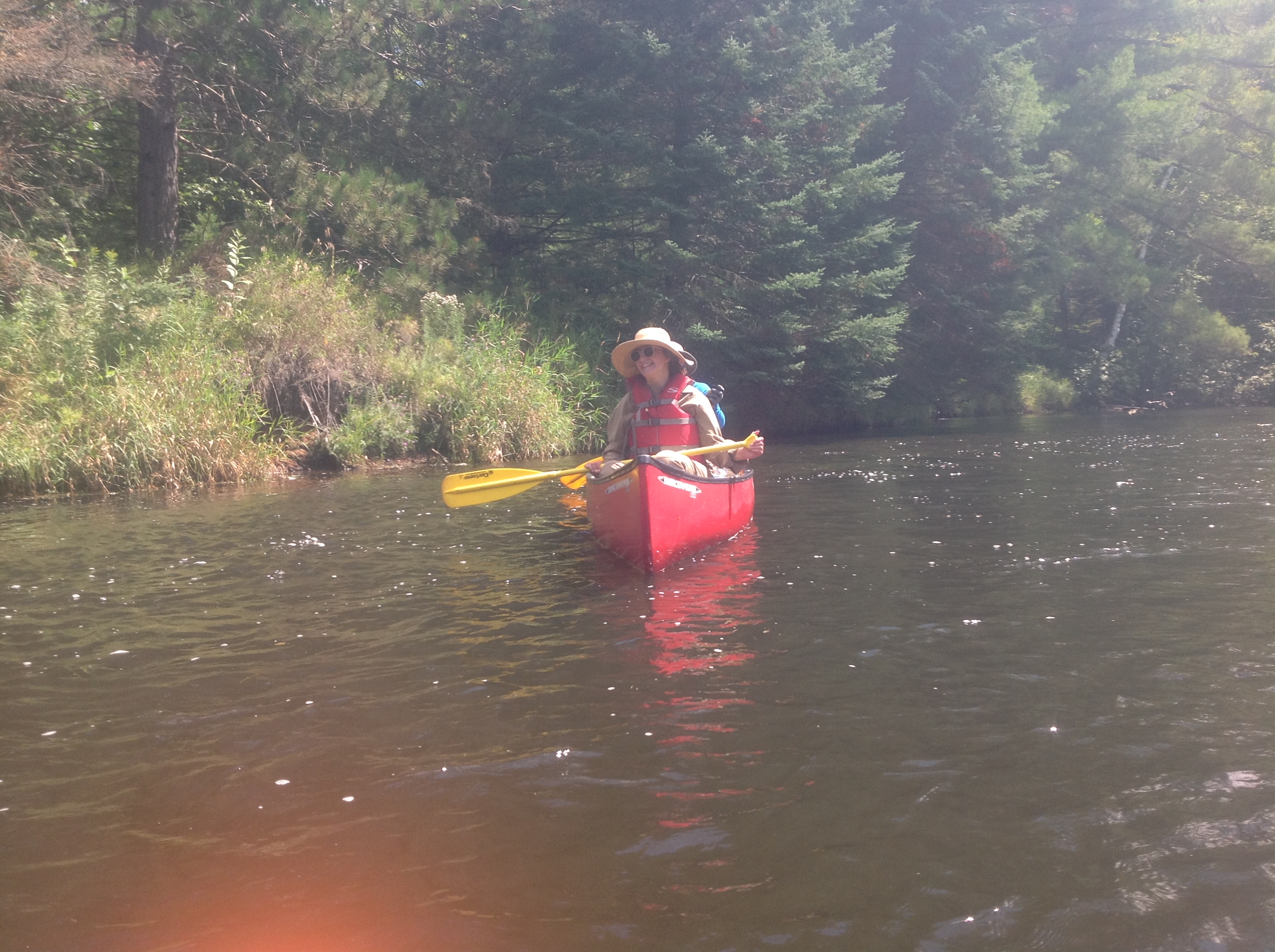
The West Fork of the Chippewa River was an adventure I took with a Natural Resources Foundation (NRF) field trip led by the Couderay Waters Regional Land Trust.The leaders taught us about fish populations here (we got to participate in seining fish) and some history of the river. I would highly suggest a trip with the NRF if you get a chance: www.wisconservation.org

This section of river has lots of flatwater and some class I rapids. Certain sections of it have lots of boulders and there is one large erratic in the river. The rapids would be more fun with higher water levels than we had. They did mention that a decade ago, the water was two feet lower, which probably made the river impassable at times. On this section of river, we saw kingfisher and two snapping turtles creating more turtle eggs, tumbling in the water as if in battle.

As the river nears Moose Lake, it turns into more of a flowage, slowing a lot. Moose lake isn’t very developed and has a unique population of hemlock and cedar on its banks. Other trees that were along this route were maple, tag alder and white pine. At the end, we were against the wind going across the lake, which made for a long last stretch after a too-sunny (and not enough water) paddle. There is a bridge to go under to enter the larger part of the lake before you reach the final destination. I had hoped that the bridge would be the dam we were taking out at! We took out at Louie’s Landing, a private resort.

Resources used: Wisconsin Gazetteer, guides from Couderay Waters Regional Land Trust.


Last paddled July 15, 2017

Namekagon River – Big Bend Landing to Namekagon River Visitor Center (7.7 miles)

I have written about parts of this section before; I did more of the river this time and will write about the whole section again. It is the most traveled section of the river, with a few outfitters along the way that rent both canoes and tubes.

The river winds through forest with a few campsites along the way that I plan to use in the future. This section isn’t very challenging but does have some riffles as you first near Highway 63. After the riffles, the river gets very sandy through lowlands and winds around smal islands/ sandbars.  The banks get higher after this area, for the ‘typical’ Namekagon feel.  You might be anle to see the Trego Nature Trail on the right bank, towards the end of the trip.

Along the way, we saw rd pine, jack pine, white pine, ash, whit birch, red maple, northern pin oak, white oak and tag alder. We didn’t see a whole lot of wildlife, but did encounter multiple merganser families!