
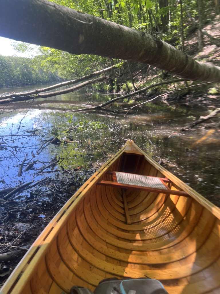
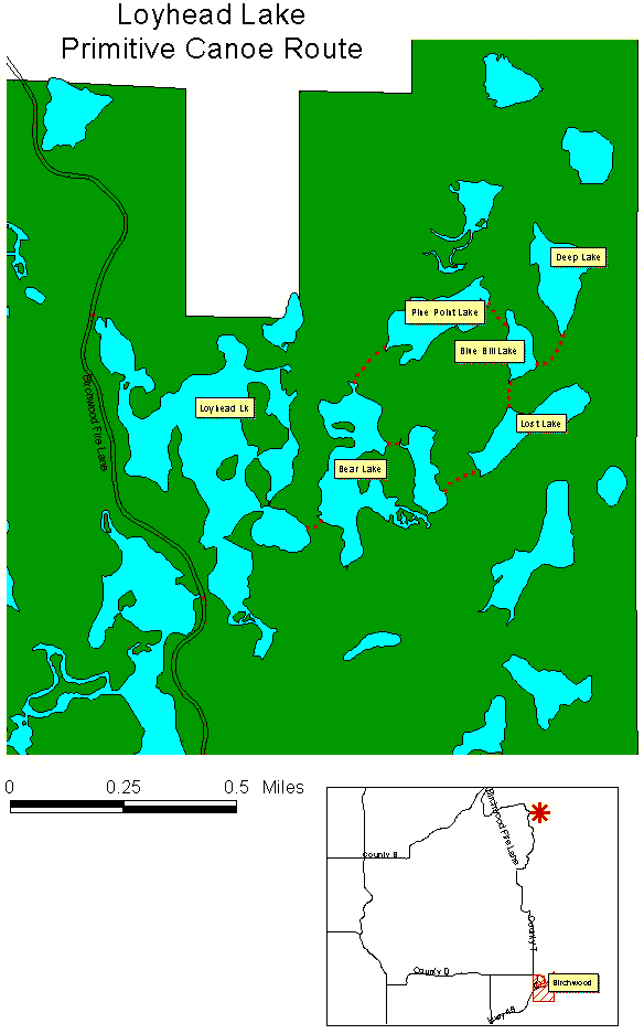
My friend Sarah was up for a few days, and we decided to paddle one of the canoe portage routes of Washburn County by Birchwood. A few miles north of Birchwood, the landing is easy to find, between Wolf and Loyhead Lakes. Loyhead Lake is to the east.
The portage route was well-marked with blue ‘PORTAGE’ signs and the map was easy to read. The routes were generally used, once you found them the trail was pretty obvious. There are enough adventurous people finding their way out there, though we said without the blue signs, it would be much harder to find the portages! Each lake, though close to each other, had a different character of the water.


Starting at Loyhead Lake, we followed the route counterclockwise. For the first portage, we had to go around a peninsula, and so long as you can read a map, it wasn’t hard to find. Some may think that it is not a place to paddle, but once through some thicker vegetation, you will easily see the blue ‘PORTAGE’ sign.
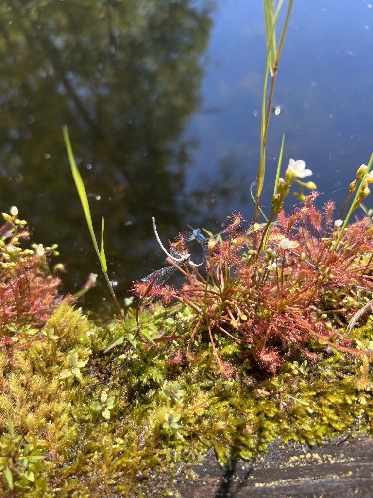
Our second lake was Bear Lake. Again, we had to go up around a peninsula to find the portage to (no name lake). On this small lake, we took a detour, to the bog on the south end of the lake. We were given a special treat on a few logs not far south of the portage trail – sundews eating mating damselflies! We watched them for a while, observing nature at its finest and cruelest – and saved one or two damselflies for now.

The portage to Lost Lake was one of the longer ones (none are long – the longest may be 200 meters). Lost Lake had brownish water.
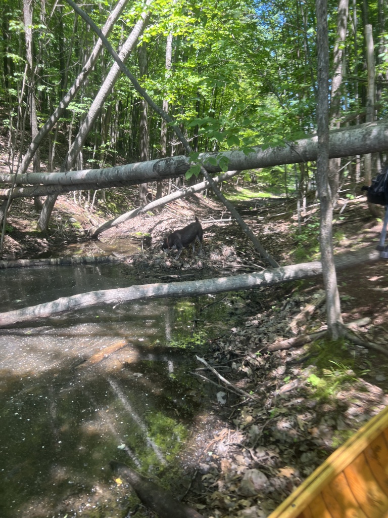
It wasn’t hard to find the next portage sign, but doing the portage was another story. The portage to Blue Bill Lake looked like it was a bit of a creek in high water – albeit not passable for all the fallen trees because of the beavers! We had seen other beaver activity as we paddled, but at this place, the portage sign showed a way through the pass, and no obvious trail to follow to get to the other lake. The understory was not thick, so we paved our own trail alongside the pass, avoiding downed trees and muck as we went.

Blue Bill Lake was the lake with the most algae. It was the smallest lake (according to the map) and had three portage trails to it! We went to the eastern one, which was rarely used, to Deep Lake. Deep Lake only had the portage trail to it, so was an end of the line. We walked to it to see it, and found tearthumb along the shoreline. We headed back and then made our way to the portage to Pike Point Lake. On Blue Bill Lake, you could easily see all three portage signs from any point.

Once on Pike Point Lake, we paddled to the west and struggled to find the portage sign for a few minutes. There is a peninsula that looked like an island – it ended up an island with a too-small channel through it. We would have had to get out and walk, and the flies were terrible! We paddled back around the island/peninsula and saw the portage sign. This was the only place that the (used) portage wasn’t obvious. We got out and found a faint trail, which was odd given the usage on the other trails. Once we found Bear Lake, we saw another trail that made the portage much shorter, though went through some shallower swamp on Pike Point Lake. If you make your way to the back of the bay, you’ll find the portage at the back. It’s worth not trying to fight the plants and find the trail right by the blue sign, if you can make it through. We didn’t have to fight shallow water, but in a drier season you may have to. If you paddle the route clockwise, you wouldn’t have a problem finding the trail, though you could have shallow paddling.


We got back onto Bear Lake, paddling past the portage we had taken earlier. The portage to Loyhead Lake is on the SW corner of the lake. Back across Loyhead Lake, we made our landing and went for a nice swim!
Beings seen include kingfisher, heron, flies, jewelweed, duckweed, smartweed (a few types), sensitive fern, water smartweed, pine sap, bull thistle, cinquefoil, white birch, aspen, sugar maple, maple- leaf viburnum, white oak, starflower, blueberry, bracken fern, wintergreen, horehound and green bulrush.
Information about the route can be found here: https://www.co.washburn.wi.us/departments/forestry/canoeing
Maps can be found here: https://www.co.washburn.wi.us/images/custom/departments/forestry/canoe/loyheadcanoe.gif
Paddled July 17, 2022
Weather: sunny, 80s
